South Africa
Global Perspective, Local Expertise.™
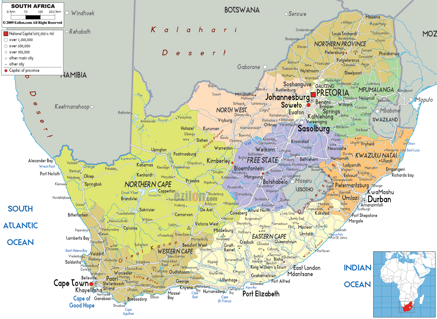
South Africa (officially the Republic of South Africa “RSA”) has 2,798 km. (1,739 mi.) of coastline that stretches along the South Atlantic and Indian oceans. To the north lie Namibia, Botswana and Zimbabwe; to the east are Mozambique and Swaziland; and within South Africa lies Lesotho, an enclave surrounded by South African territory. South Africa is the 25th-largest country in the world by land area, and with close to 53 million people, is the world’s 25th-most populous nation.
South Africa has 9 provinces. The provinces are in turn divided into 52 districts: 8 metropolitan districts + 44 district-municipalities. The district-municipalities are further subdivided into 226 local municipalities.
Eastern Cape Province
Bhisho (capital)
Port Elizabeth (largest city)
Free State Province
Bloemfontein (capital & largest city)
Gauteng Province
Johannesburg (capital & largest city)
KwaZulu-Natal Province
Pietermaritzburg (capital)
Durban (largest city)
Limpopo Province
Polokwane (capital & largest city)
Mpumalanga Province
Nelspruit (capital & largest city)
North West Province
Mahikeng (capital)
Rustenburg (largest city)
Northern Cape Province
Kimberley (capital & largest city)
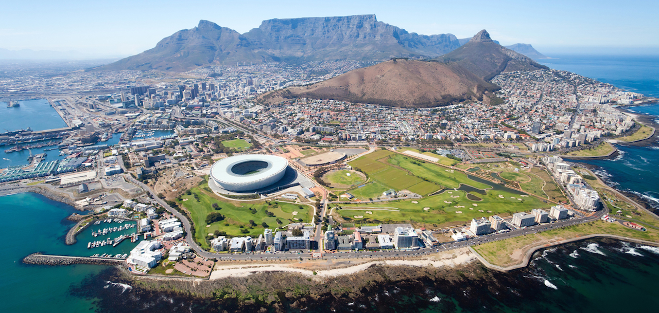
Western Cape Province
Cape Town (capital & largest city)